


Blue Springs, Covington County, Alabama
About
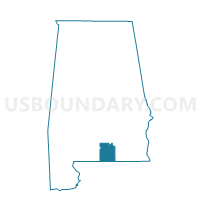
Outline

Summary
| Unique Area Identifier | 521553 |
| Name | Blue Springs |
| County | Covington County |
| State | Alabama |
| Area (square miles) | 41.02 |
| Land Area (square miles) | 40.64 |
| Water Area (square miles) | 0.37 |
| % of Land Area | 99.09 |
| % of Water Area | 0.91 |
| Latitude of the Internal Point | 31.17862010 |
| Longtitude of the Internal Point | -86.33133310 |
Maps


Graphs
Select a template below for downloading or customizing gragh for Blue Springs, Covington County, Alabama


Neighbors
Neighoring Voting District (by Name) Neighboring Voting District on the Map
- Babbie-Cedar Grove, Covington County, AL
- Beulah BC, Covington County, AL
- Florala -Boles Mill, Covington County, AL
- Lockhart-Damacus, Covington County, AL
- Opp, Covington County, AL
- Sanford-Oakey Ridge, Covington County, AL
- Stanley-Enon-McAdams, Covington County, AL
Top 10 Neighboring County Subdivision (by Population) Neighboring County Subdivision on the Map
- Andalusia CCD, Covington County, AL (18,495)
- Opp CCD, Covington County, AL (9,607)
- Florala CCD, Covington County, AL (3,684)
Top 10 Neighboring Place (by Population) Neighboring Place on the Map
Top 10 Neighboring Unified School District (by Population) Neighboring Unified School District on the Map
Top 10 Neighboring State Legislative District Lower Chamber (by Population) Neighboring State Legislative District Lower Chamber on the Map
Top 10 Neighboring State Legislative District Upper Chamber (by Population) Neighboring State Legislative District Upper Chamber on the Map
Top 10 Neighboring 111th Congressional District (by Population) Neighboring 111th Congressional District on the Map
Top 10 Neighboring Census Tract (by Population) Neighboring Census Tract on the Map
- Census Tract 9630, Covington County, AL (3,684)
- Census Tract 9623, Covington County, AL (3,279)
- Census Tract 9628, Covington County, AL (1,736)
- Census Tract 9626, Covington County, AL (1,517)